THE BEST OF B&G® IN AN APP
THE PERFECT COMPANION FOR ANY SAILOR
- Plan
- Sync
- Navigate
- Review
THE BEST OF B&G® IN AN APP
THE PERFECT COMPANION FOR ANY SAILOR
- Plan
- Sync
- Navigate
- Review
THE PERFECT COMPANION
FOR ANY SAILOR

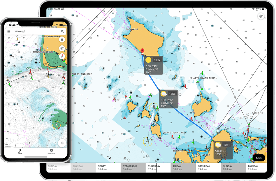
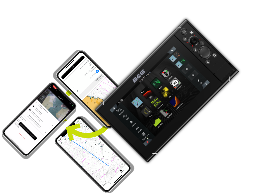
With all the latest and most detailed charts from C-MAP®, the B&G App allows you to plan, sync, navigate and review all the sailing, weather, tide and navigation information you will ever need in one simple and easy to use mobile app.
DOWNLOAD FREE NOW


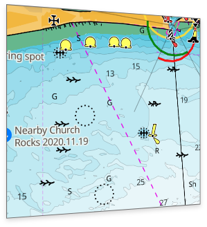
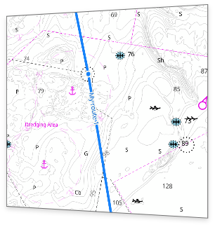
Detailed Charts
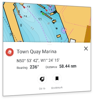
Points of Interest
Detailed Marina & Port Plans
Autorouting
Weather, Tide & Current Overlays
![]()
Plan
All the tools you need to plan your sailing trips in advance.
With the B&G App you can plot your waypoints and set your route in advance from the comfort of your home, checking the weather and time along the route. Use Autorouting and let the app do the hard work, providing an automated and optimised route to your destination. Plus, discover and mark a variety of Points of Interest for your trip.
![]()
Sync
Synchronise your planning data with your B&G chartplotter anytime, anywhere
Once you have planned your route, the B&G App allows you the freedom and flexibility to save your waypoints, routes and tracks and then simply synchronise with your B&G chartplotter when you step on board, so you can make the most of your time on the water.
![]()
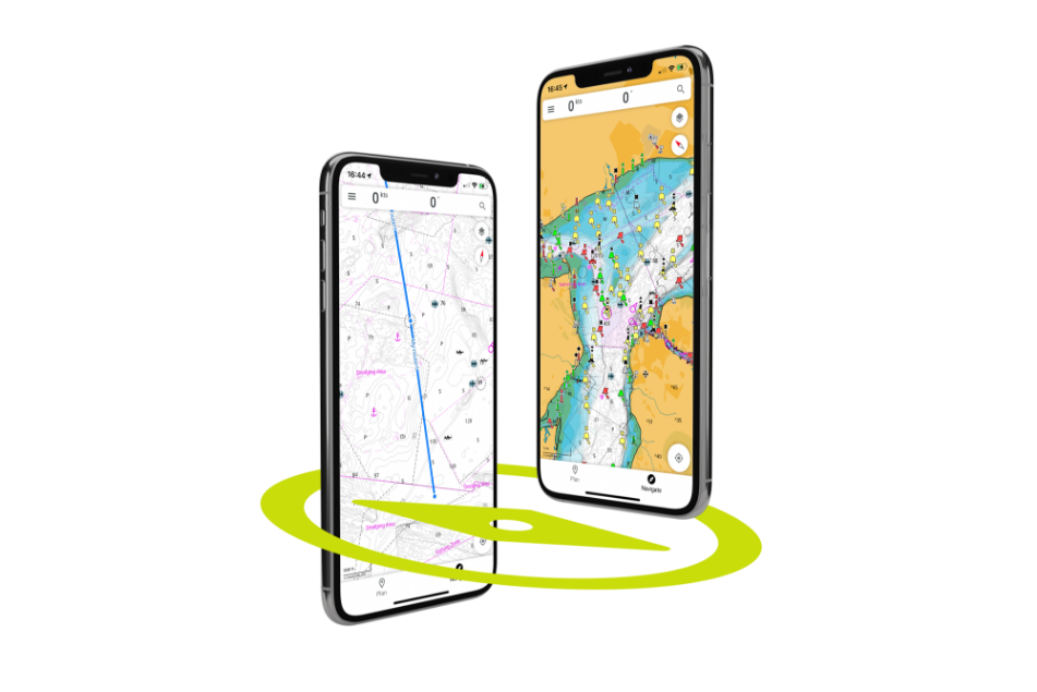
Navigate
Explore and navigate along routes and waypoints
with the latest C-MAP® charts
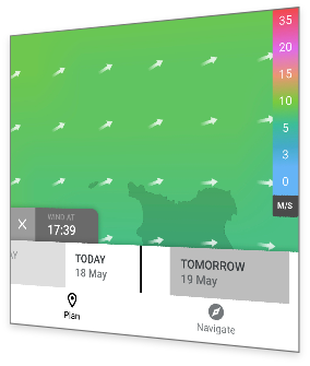
Use your app as an extension of your chartplotter, easily check position, route on the app’s high-resolution nautical charts and with one tap discover real-time weather data with weather and tide overlays, wind, sea-state and waves, temperature, precipitation and much more.
![]()
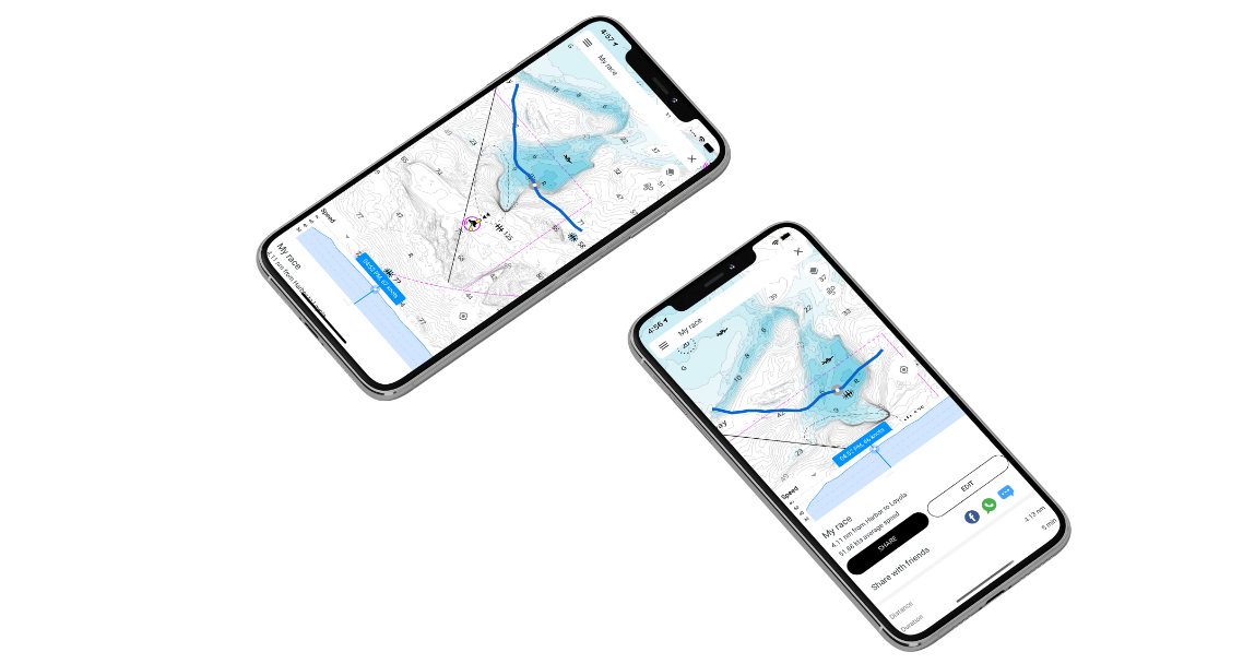
Review
Store all your trip and race data and review when you need
The B&G App is just like having a digital logbook for your boat and past trips, available at your fingertips. Useful for servicing, managing waypoints, improving racing skills and planning future trips.
![]()
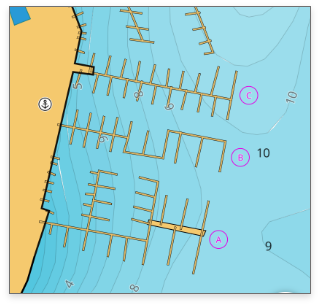
Latest C-MAP charts
With high-resolution bathymetry, the maps are carefully crafted to highlight the most important information at any given time and are continuously updated.
![]()
Chart personalisation
Personalise the map to your preferences including chart colourways and detail levels, map rotation, your boat data such as height and depth limits and much more.
![]()
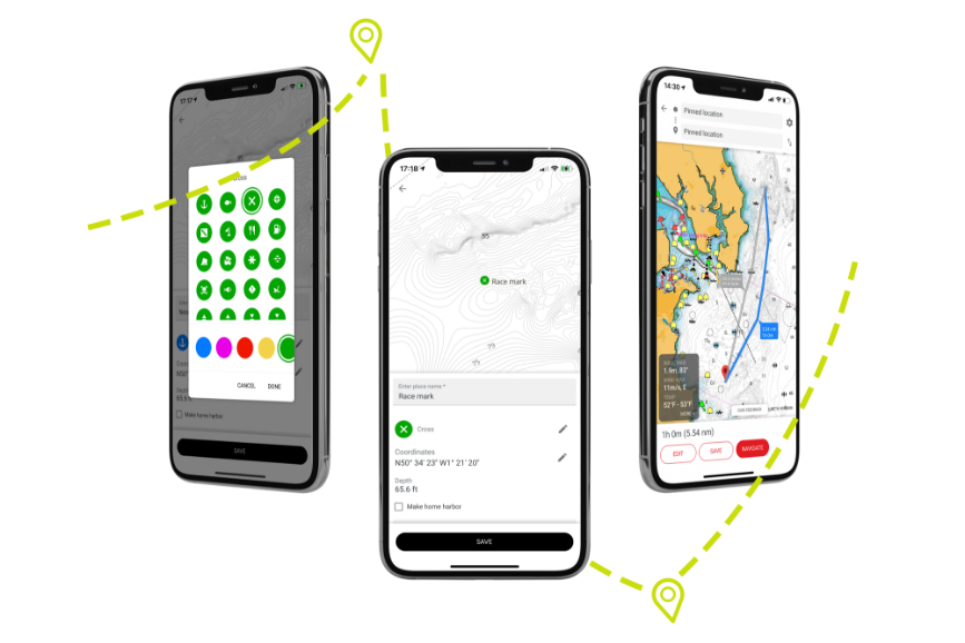
Personal waypoints, routes & tracks
With the B&G App you can create, access, edit and share your waypoints, routes and tracks anytime, anywhere.
![]()
Autorouting
The best routing in an app, it lets you plot a route and check your ETA quickly, as well as weather along the route.
![]()
Points of Interest
Explore thousands of points of interest such as marinas, harbours, beaches, shops and much more.
![]()
Mirroring and Control
Mirror and remotely control your connected B&G chartplotter* through the app, offering the ultimate freedom and control onboard.
*This feature is not compatible with Zeus® S.
![]()
Traffic
Share your position with friends and family. This feature allows you to be seen and see other app users around you out on the water.
![]()
AIS
See boats with class A and B enabled AIS within a 100km radius, as well as their position, speed and course, without sharing your position.
![]()
Device Help & Support
Register and connect your B&G devices to the app and access a library of manuals, guides and how to videos.
Subscription Comparison
| FREE | |
| Up-To-Date Nautical Charts | |
| Personal Waypoints, Routes and Tracks | |
| Manual And Autorouting | |
| Measure Distance Tool | |
| Thousands of points of interest | |
| Weather Along The Route For 24 Hours | |
| Weather Overlay For 24 Hours | |
| GPX Import and Export | |
| Chart Personalization: Boat Size, Favourite Units Of Measurement, Favourite Map Type Or View Mode (Auto, Light Or Dark) And More | |
| Device registration | |
| Software Updates | |
| Device Support: Manuals, Guides, Videos | |
| Mirroring and Control | |
| Offline Sync Of Waypoints, Routes And Tracks | |
| NEW: Sharing Tracks | |
| NEW: Personalised Push Notifications | |
|
PREMIUM Everything in FREE plus: |
|
| Offline maps (Global chart) | |
| AIS vessel display | |
| 5-Day Weather Along The Route | |
| Navigation: GPS Data, Navigation Line, Track Record | |
| Traffic: Keep An Eye On Other App Users Around You | |
| 5-Day Weather Overlay | |
| High-Resolution Bathymetry | |
| Shaded Relief chart layer | |
| Custom Depth Shading | |
| NEW: Anchoring Alert | |
| NEW: Satellite Overlay | |
How to do weather along the route
How to Sync
How to do Autorouting
Ratings and reviews


DOWNLOAD FREE NOW


