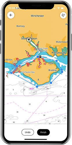
A useful tool for planning your race is the B&G App. This lets you plan your route and enter your waypoints from the comfort of your sofa and then synchronise these to your on-board chartplotter when you get to the boat. You can also inspect areas of the course and familiarise yourself with them before the big day.
1: Add your route on the app
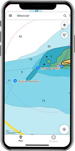
Using the B&G App, plan your route around the island, using the course given by the organisers as your guide. Areas to pay particular attention to are:
The Needles, where the wreck of the Varvassi presents a significant hazard. Make your choice and add your waypoints to keep you clear of any dangers.
Ryde Sands: Make sure that your route takes you safely outside the sands – while gains can be made here, you can also come to a grinding halt as you run aground, so it’s worth double checking your waypoints here in particular.
2: Register your chartplotter
Tap the power button on your Zeus or Vulcan chartplotter, then tap Connect And Register. This will prompt you to Connect your B&G device to your B&G app by scanning a QR code. Once this process is complete, your chartplotter will appear in the list of your devices on the app.
You need to log in on the chartplotter to ‘My B&G Account’ under Settings > Services using your app login credentials. Scan the QR code that appears on the chartplotter screen using your phone and you’ll be asked to confirm that you want to connect to this account.
3: Synchronise your waypoints and routes
When you are ready to synchronise between App and chartplotter, connect your chartplotter to the marina wifi or a mobile hotspot so that it can access the internet.
This done, swipe down from the top of the screen or tap the power button and you will see a ‘synchronise my data’ button. Tap this, and your routes and waypoints should synchronise between app and chartplotter, and you’re good to go.